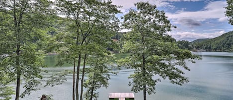
Watauga Lake, nestled in the Appalachian Mountains and the Cherokee National Forest in northeastern Tennessee, enjoys the most stunningly beautiful lake and mountain views in the 'Volunteer State'. Started in 1942 and finally dammed on the last day of 1948, Watauga Lake is the TVA's highest-elevated reservoir in Tennessee. Surrounded by densely forested mountains in the "high country", Watauga Lake sits 1,959 feet above sea level at "full pool" (full summertime elevation). At Watauga Lake, it's usually a few degrees cooler than similar locations closer to sea level.
Watauga's surface covers 10.05 square miles of two mostly-rural Tennessee counties: Johnson County and Carter County. Watauga Lake is accessible only by winding mountain roads. The Appalachian Trail crosses the southwestern tip of Watauga Lake. The lake is located south of Mountain City (Tennessee), west of Boone (North Carolina), east of Elizabethton (Tennessee), southeast of Bristol (Tennessee), southwest of Damascus (Virginia), and northeast of Johnson City (Tennessee).
Part of Watauga Lake covers what was once Butler, Tennessee. Old Butler -- as it is now called -- was a town where Native Americans interacted with white settlers, Daniel Boone stopped to rest, and pioneer families farmed for generations. The TVA's decision to dam the Watauga and Elk Rivers sealed Old Butler's fate: it would soon lie on the bottom of the new lake.
Instead of watching Old Butler disappear, its citizens relocated their town to higher ground. "New" Butler is located lakeside and is home to the Butler Museum, which preserves the history of life in Old Butler. The museum has exhibits, artifacts, and displays with old quilts, photos of the old downtown, and other reminders of Old Butler. More than just a museum, it takes visitors back to the pre-Watauga Lake days of Old Butler.